

DESCRIPTION
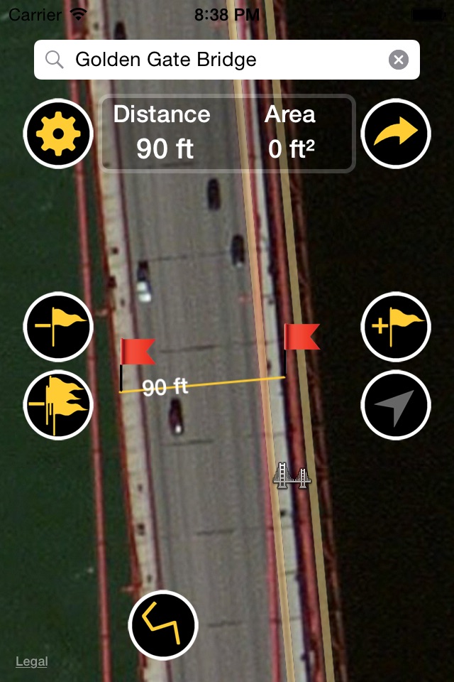
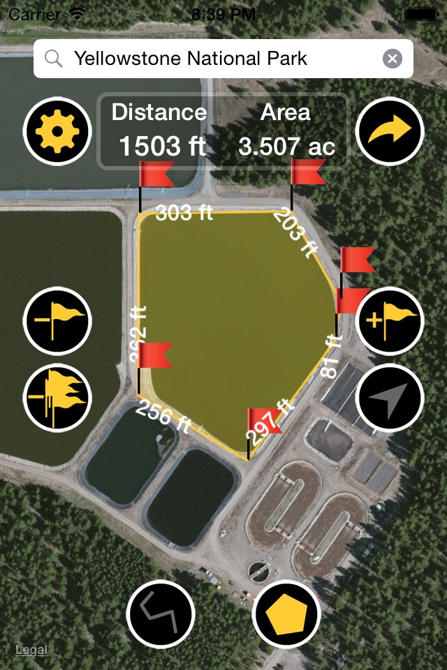
Planimeter is a powerful tool to measure and calculate distance between multiple points on the map, and land area, all expressed in the measuring units you choose. This app uses Apple Maps, GPS and Network location services, ideal companion wherever you go.
Keep in mind that GPS works best with a full and clear view of the sky.
FEATURES
+ Calculate total distance and distance between adjacent flags
+ Calculate area, despite its shape
+ Precisely drop and move flags with help of magnifier which shows the map under your finger
+ Remove one by one or all the flags at once, the shape is automatically recreated, and values are updated
+ Determine your GPS location
+ Distance units: m, km, yd, ft, mile, nautic mile
+ Area units: m2, km2, ft2, ac, yd2, mi2, nmi2
+ Search regions on the map by address, city, counties, rivers, mountains, islands, countries...
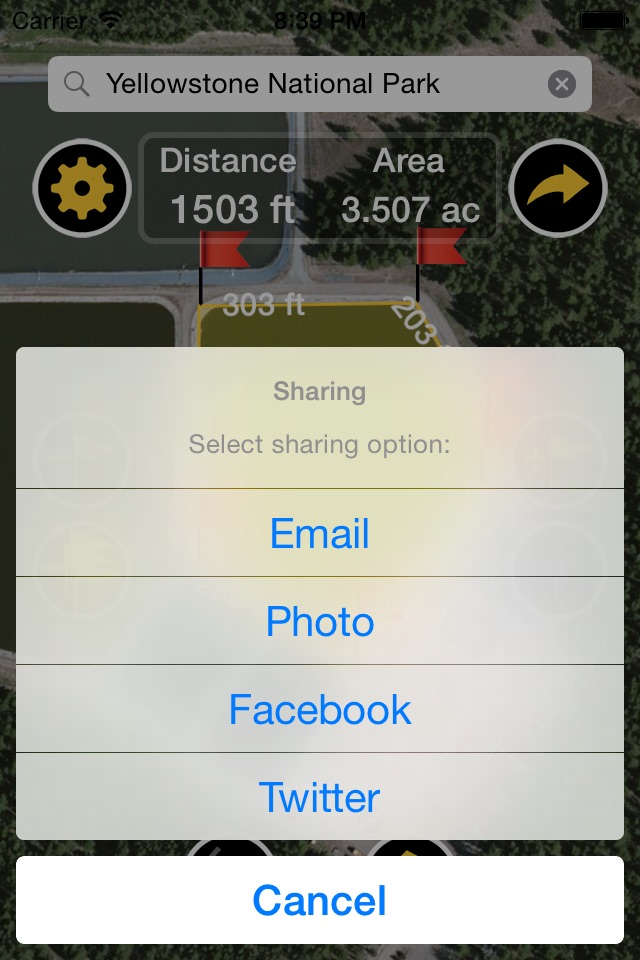
+ Save screenshot to Photos or share it on E-mail, Facebook or Twitter
+ Standard, Satellite or Hybrid type of the map
USE
+ Road repairing, paving, concrete, seal coating,
+ Roofing, building fences, underground utilities,
+ Outdoor activities,
+ Land survey,
+ Sports,
+ Range finder applications,
+ Bike or run tour planning,
+ Exploring golf area,
+ Golf distance meter,
+ Running, walking, biking, jog tracking,
+ Field pasture area measure,
+ Garden and farm work and crop planning,
+ Area records,
+ Construction, fencing, agricultural fencing,
+ Solar panel installation - roof area estimation,
+ Trip planning,
+ Topography tasks...